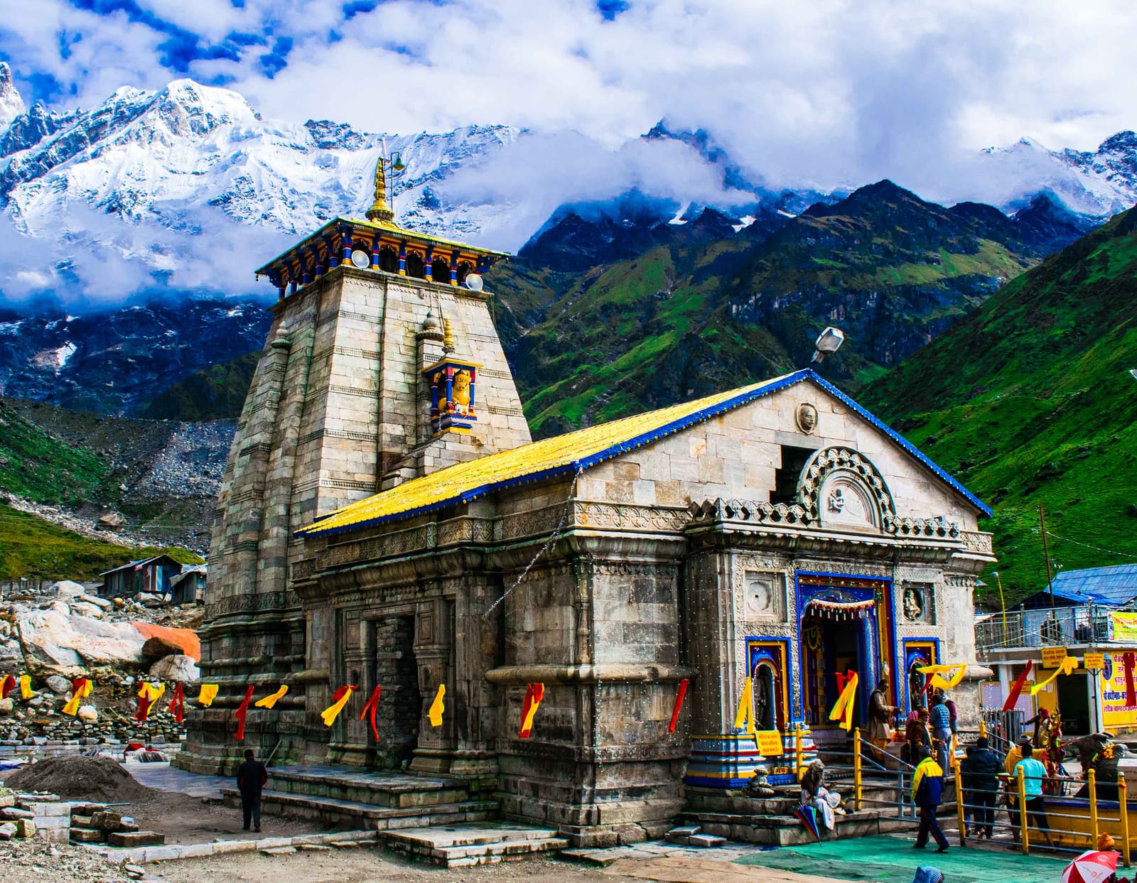
Chota Char Dham Yatra Guide
Four Himalayan shrines in the Garhwal mountains — Yamunotri, the source of the Yamuna; Gangotri, the birthplace of the Ganga; Kedarnath, the highest Jyotirlinga; and Badrinath, Vishnu's mountain abode.
The Himalayan Char Dham
The Chota Char Dham (Hindi: छोटा चार धाम — "small four abodes") is a high-altitude pilgrimage circuit in the Garhwal region of Uttarakhand. Unlike the All-India Char Dham (Badrinath, Dwarka, Puri, and Rameshwaram), which spans the four cardinal directions of the subcontinent, the Chota Char Dham is concentrated in a single mountain landscape — the upper valleys of the Bhagirathi, Alaknanda, and Yamuna river systems, where three of India's holiest rivers originate within a 50-kilometer radius.
The circuit comprises four shrines: Yamunotri (source of the Yamuna), Gangotri (source of the Ganga), Kedarnath (the Himalayan Jyotirlinga), and Badrinath(Vishnu's abode). Together, they represent the complete arc of Hindu sacred geography compressed into a single journey — from the glacial sources of rivers to the highest Shiva shrine in the world.
The pilgrimage is traditionally undertaken from west to east: Yamunotri first, then Gangotri, then Kedarnath, and finally Badrinath. The total circuit covers approximately 1,000 kilometers by road across high mountain passes, with significant trekking sections that require physical preparation. It is considered one of the most spiritually meritorious pilgrimages in Hinduism, ranking alongside the Kumbh Mela and the original Char Dham in religious importance.
History and Origin
Unlike the original Char Dham, which was formalized by Adi Shankaracharya in the 8th century, the Chota Char Dham as a combined circuit is a more recent development. The individual shrines have ancient origins — Kedarnath is mentioned in the Mahabharata, and Badrinath was a Buddhist vihara before Shankaracharya reconsecrated it — but the grouping of all four into a single pilgrimage itinerary gained popularity only in the 19th and early 20th centuries, aided by improved road access and the publication of pilgrimage guides.
The connection between the four sites is geographical rather than theological. Each shrine occupies a distinct river valley within the Garhwal Himalayas. Yamunotri lies in the upper Yamuna valley. Gangotri guards the headwaters of the Bhagirathi, the primary source stream of the Ganga. Kedarnath is set in the Mandakini valley, a tributary of the Alaknanda. Badrinath stands at the head of the Alaknanda valley. To traverse all four is to trace the entire watershed of the upper Ganga system.
The term "Chota Char Dham" itself reflects a colonial-era distinction. British administrators and early travel writers used "Chota" (small) to differentiate the Himalayan circuit from the pan-Indian "Bada" (great) Char Dham. The distinction stuck, though it is misleading — the Chota Char Dham is physically more demanding than its larger namesake, requiring pilgrims to trek at altitudes above 3,000 meters through terrain that is snowbound for half the year.
Today, the Chota Char Dham attracts over a million pilgrims annually, making it one of the most-visited pilgrimage circuits in the world. The government has invested heavily in infrastructure — the Char Dham Highway Project aims to provide all-weather connectivity to all four shrines, though environmental concerns about the ecological impact of road construction in fragile alpine zones remain a subject of debate. The tension between accessibility and preservation is the defining challenge of the modern Chota Char Dham.
The Four Himalayan Shrines
Each shrine occupies a distinct ecological zone, from the riverine forests of the lower valleys to the alpine meadows above the tree line.
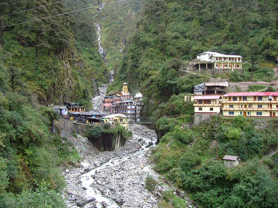
Yamunotri
Source of the Yamuna
At 3,293m in the Garhwal Himalayas, the Yamuna emerges from the Champasar Glacier above. Pilgrims cook rice in Surya Kund's geothermal springs as sacred offering before darshan.
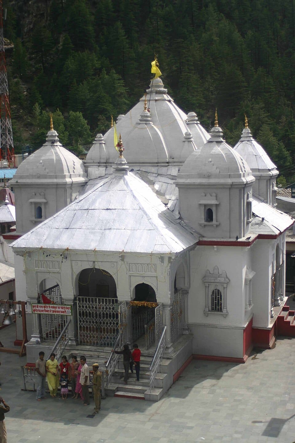
Gangotri
Gateway of the Ganga
At 3,100m where the Bhagirathi flows from Gomukh glacier, Adi Shankaracharya installed the goddess's 8th-century image. The river descends 6,000m here towards the plains.
Kedarnath
The Himalayan Jyotirlinga
Highest of the 12 Jyotirlingas at 3,583m. Its rough triangular lingam is the fossilized hump of Shiva's bull. The 2013 flood could not move its granite slabs.
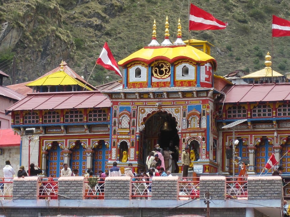
Badrinath
Vishnu's Himalayan Abode
The northern terminus of the Uttarakhand yatra, where the Alaknanda river valley narrows into a glacial canyon. Badrinath's image of Vishnu as both meditative ascetic and lord of the mountains was established by Shankaracharya in a former Buddhist cave-shrine.
Planning Your Journey
Best Time to Visit
The temples open from late April or early May on Akshaya Tritiya and remain open until Diwali (October-November). The peak season is May-June, with heavy crowds and premium pricing. September-October offers clearer skies, lush post-monsoon landscapes, and fewer pilgrims. Kedarnath closes earliest, typically by mid-October.
Registration Requirement
Biometric registration is mandatory for all pilgrims. Register online through the Uttarakhand Tourism website or at physical counters in Haridwar and Rishikesh. Registration involves fingerprint scanning and identity verification. Your registration number must be carried throughout the yatra and is checked at multiple points along the route.
Health & Fitness
The yatra involves altitudes from 3,000m to 3,600m. Kedarnath requires a 16km trek from Gaurikund (or a helicopter from Guptkashi). Yamunotri involves a 6km trek from Janki Chatti. Acclimatization, adequate hydration, and a fitness check-up are strongly recommended. Altitude sickness affects even fit individuals — carry Diamox and consult your doctor before departure.
Essential Packing List
- Heavy woolens for Kedarnath and Badrinath (temperatures near freezing even in summer)
- Raincoat and waterproof trekking shoes for monsoon rains and stream crossings
- Personal first-aid kit with altitude sickness medication (Diamox recommended)
- Headlamp or flashlight with spare batteries for early morning darshan queues
- Sunscreen, moisturizer, and UV-protection sunglasses for high-altitude exposure
- Dry fruits, energy bars, and glucose for trekking sections
- Water purifying tablets or filtration bottle (tap water is not potable at altitude)
Common Questions
What is the difference between Char Dham and Chota Char Dham?
The original Char Dham spans India's four cardinal directions (Badrinath, Dwarka, Puri, Rameshwaram). The Chota Char Dham is a Himalayan circuit of four Uttarakhand shrines (Yamunotri, Gangotri, Kedarnath, Badrinath). Badrinath is the only shrine common to both.
What is the best way to travel for Chota Char Dham Yatra?
Road travel from Haridwar or Rishikesh is standard. Helicopter services reduce the circuit to 2-5 days. The Kedarnath trek (16km from Gaurikund) and Yamunotri trek (6km from Janki Chatti) remain on foot or by pony/palki.
Is the yatra safe for elderly people?
Yes, but a medical checkup is advised. Palkis, ponies, and helicopters are available for difficult sections. Altitude affects everyone — rest days are built into standard itineraries.
How many days are required?
A road journey takes 10-12 days. Helicopter packages complete the circuit in 2-5 days. The traditional West-to-East order is Yamunotri → Gangotri → Kedarnath → Badrinath.
Do I need any special permits?
Mandatory biometric registration is required for all pilgrims. Register online via Uttarakhand Tourism or at physical counters in Haridwar and Rishikesh.
Which months are the temples open?
All four open on Akshaya Tritiya (late April/early May) and close by Diwali (Oct-Nov). Kedarnath closes earliest. November-April sees all temples closed with deities moved to winter seats.
What makes each shrine unique?
Yamunotri has geothermal springs. Gangotri marks the Ganga's glacial source. Kedarnath is the highest Jyotirlinga with a triangular bull-hump lingam. Badrinath is the only shrine shared with the original Char Dham.
How does Kedarnath connect to the 12 Jyotirlingas?
Kedarnath is one of the twelve Jyotirlingas — the highest at 3,583m. Its self-manifested triangular lingam is unique among the twelve. The Chota Char Dham yatra thus also completes a key stop on the Jyotirlinga circuit.
Traditional Route
Haridwar → Rishikesh → Barkot → Yamunotri → Uttarkashi → Gangotri → Guptkashi → Kedarnath → Rudraprayag → Badrinath → Rishikesh.
Total distance: ~1,000 km by road. Altitude range: 300m (Haridwar) to 3,583m (Kedarnath).
Sources and References
This guide draws on official pilgrimage documentation, academic publications on Himalayan sacred geography, and temple authorities' historical records.
— every record linked above was re-requested for this release, so the link still resolves and the publisher still serves the document. It is a link check, not a re-verification of every sentence on this page.
Kedarnath: History, Legend and Architecture
Uttarakhand Tourism Department
The Ganga: A Sacred Geography
Diana L. Eck, Harvard University Press
Garhwal Himalayas: Pilgrimage and Environment
Dr. M.P. Joshi (Academic Publication)
Adi Shankaracharya: His Life and Times
Swami Tapasyananda, Sri Ramakrishna Math